How Directional Drilling Works in Raleigh-Area Ground
Three grounds, one metro
Raleigh sits where three geologic stories meet. West and north: piedmont — residual clays weathered from granite and gneiss, where the depth of workable clay is a lot-by-lot question. Through the middle: a buried Triassic rift basin whose red mudstones and siltstones drill softer and smoother than crystalline rock, a genuine local advantage where alignments can use it. East through Johnston: the fall-line handoff to coastal-plain sands, fast drilling with a participating water table. The honest quote names which ground — and prices footage classes separately when an alignment crosses between them, which in this metro it often does.
Growth tempo is a site condition
Wake County's growth curve isn't context here — it's a working condition. Crews compete for the same corridors as roadbuilders, locate systems run at volume, NCDOT queues carry the whole region's paperwork, and a subdivision that was a field at scoping may be pouring driveways at mobilization. The operational answers are boring ones done well: early permit filing, tight utility coordination, locate cadence planned to the week, and quotes whose schedules reflect the metro's actual pace rather than a quieter market's.
The sequence, Triangle edition
Standard bones: One-Call locates plus private designating, potholes on every crossing utility, pilot bore on profile, reaming to roughly one and a half times product, pullback, restoration. Local bends: transition tooling staged where the ground map says the rock or the sand begins, erosion control to the Neuse basin's serious standards, and restoration at subdivision-warranty quality — in a metro selling new houses this fast, the surface gets inspected twice.
Who owns what you're crossing
Municipal streets carry their towns' ROW permits — Raleigh, Cary, Apex, and the rest each run their own counter. The state system, unusually broad in North Carolina, runs on NCDOT encroachments. The Neuse and its tributaries bring buffer and water-quality authorities, with watershed seriousness near Falls Lake. Railroads permit their own corridors on their own clocks. The quote names every owner on your alignment; each one is schedule.
Straight answers
Will you hit rock on my bore?
Depends which of the three grounds you're in: piedmont says price as if you might, the Triassic basin says probably softer than you fear, and Johnston's sands say rock is rarely the question. The quote states the assumption for your actual alignment, and geotech turns it from assumption to plan.
How deep do bores run under Raleigh-area streets?
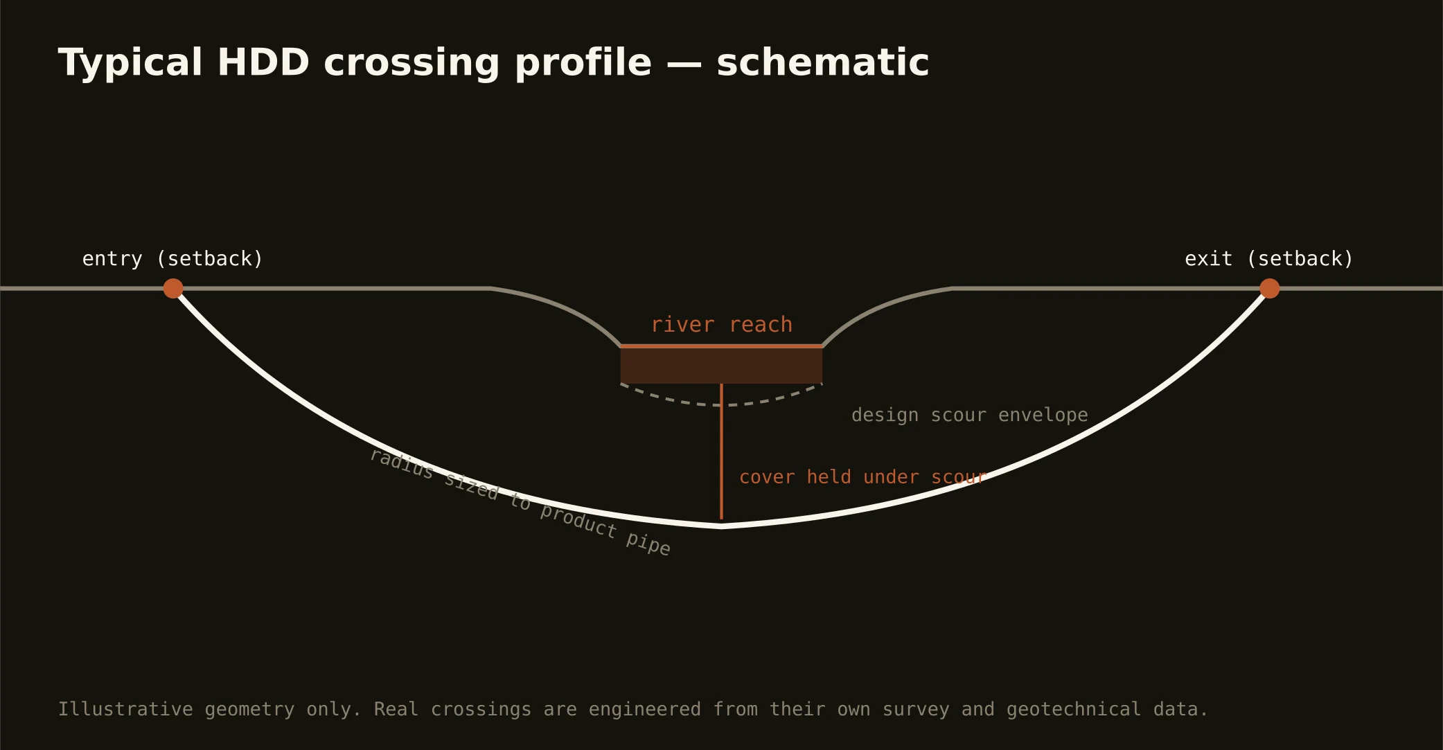
Cover follows the owning authority's standard — municipal or NCDOT — and sits below everything potholed on the alignment. River and rail crossings run deeper, set by the engineering and the basin's rules. The bore plan states your number before mobilization.
How early should we get you involved on a growth-corridor project?
At design, ideally — early enough to file NCDOT encroachments and buffer paperwork before the schedule needs them, and to route around the ground surprises the three-ground map warns about. In this metro, the cheap week is the early one.
Ready to put a number on a real crossing? Send the scope — a person prices it.